

You can find on this page the Tunisia population map to print and to download in PDF. The Tunisia population density map presents the number of inhabitants in relation to the country size and the structure of the population of Tunisia in Northern Africa.
The Tunisia population density map shows the number of inhabitants in relation to Tunisia size. This demographic map of Tunisia will allow you to know demography and structure of the population of Tunisia in Northern Africa. The Tunisia density map is downloadable in PDF, printable and free.
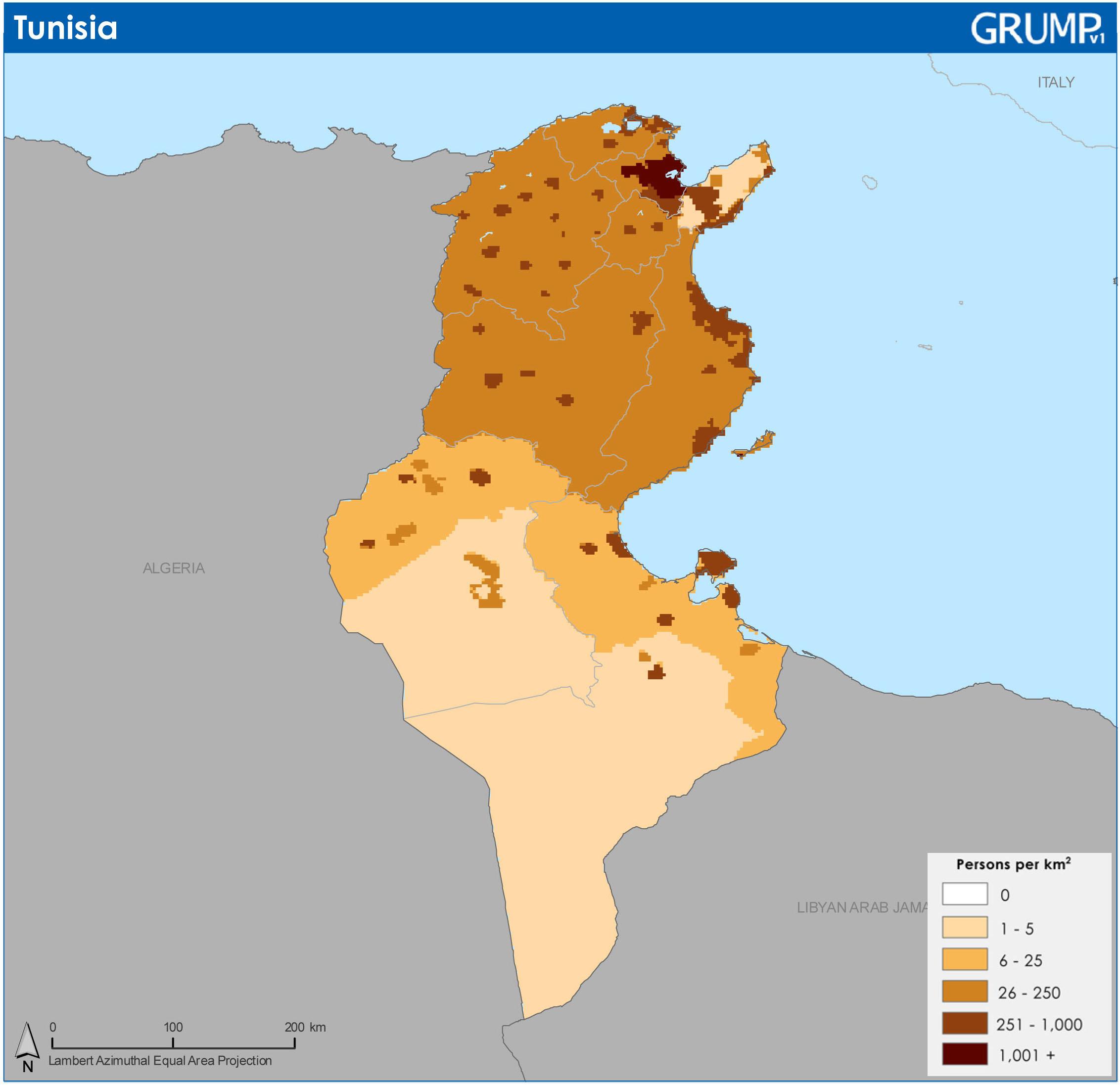
Tunisia ranks number 79 in the list of countries (and dependencies) by population. The population density in Tunisia is 76 per Km2 (197 people per mi2). The total land area is 155,360 Km2 (59,985 sq. miles). 70.1 % of the population is urban (8,280,799 people in 2020) as you can see in Tunisia population density map. The median age in Tunisia is 32.8 years.
According to the most recent projections, Tunisia population density will continue to grow until 2058, when the population will plateau at about 13.96 million people. Following this plateau, the population will begin to slowly decline and reach 13.01 million by 2099. Tunisia population growth rate from 2019 to 2020 is 1.06% as its shown in Tunisia population density map. This rate will continue to decrease as Tunisia approaches its peak population in 2058. Tunisia fertility rate is just above the population replacement rate at 2.2 births per woman, which is declining slowly, and the country experiences negative net migration each year. These two factors will continue to bring down the population growth rate until it is zero and the population begins to decline in the years following. In the 1960s, the Tunisian government introduced the first family planning program in Africa to decrease population growth to improve socio-economic development. The effects of this program are seen today with the decreasing population growth rate.
Tunisia is mostly made up of people from distinct and mixed Berber and Arab descent. About 98% of the population density identifies as Arabs, while just 1% are purely Berber and live in the Dahar mountains and the island of Djerba as its mentioned in Tunisia population density map. Between the late 19th century and through the 1950's, Tunisia had large populations of French and Italians, who combined made up 255,000 in 1956. Virtually all of the Europeans and the Jewish population left after the country gained independence. There was a history of Jews in the region going back 2,000 years. While the 1948 Jewish population was over 105,000, it was reduced to just 1,500 by 2003. The Berbers are the first known inhabitants of the region, although today Tunisia reflects many civilizations who have invaded, migrated to and been assimilated into the population over the last thousand years.